
![]()
« Where are we living? | The obligation | duties | protected areas | comparing sizes | population growth | land-use | comparative sizes | graphic «
![]()
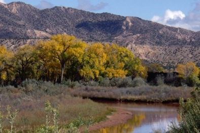
Riparian woodland in New Mexico.
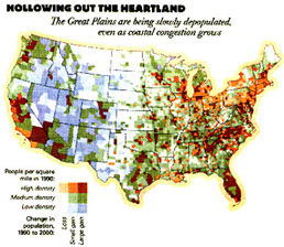
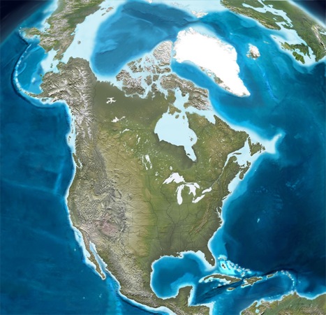
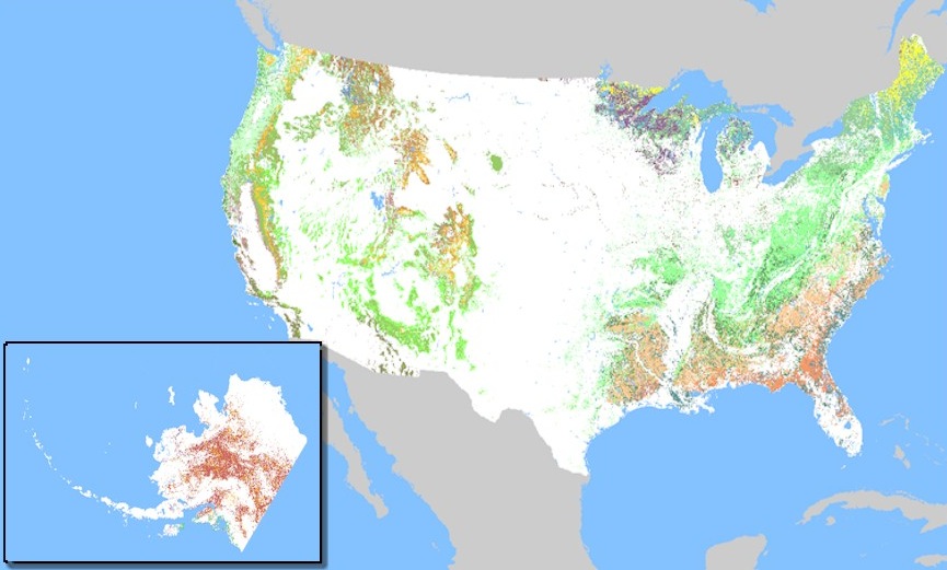
Where Americans lived in the last two decades is shown on the map below.

". . . the U.S. area devoted to roads and parking lots covers an estimated 16 million hectares (61,000 square miles), an expanse approaching the size of the 21 million hectares that U.S. farmers planted in wheat last year. But this paving of land in industrial countries is slowing as countries approach automobile saturation. In the United States, there are three vehicles for every four people.
In Western Europe and Japan, there is typically one acre for every two people."
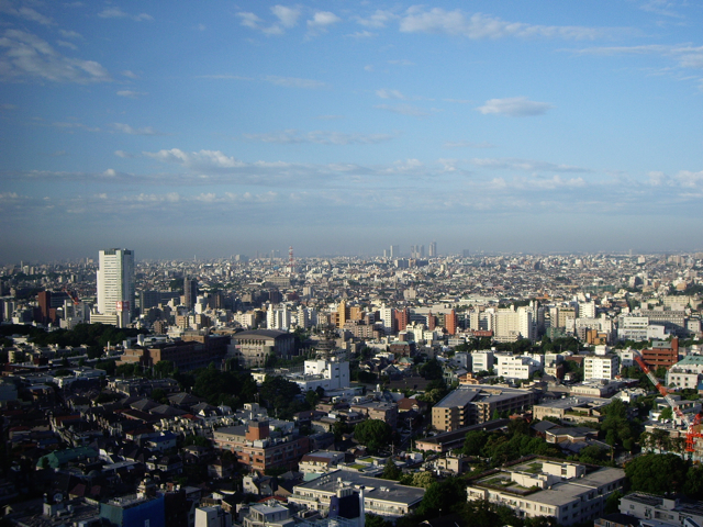
Tokyo, Japan.
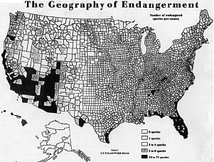
What is worth protecting for the nation's future?
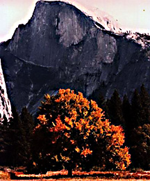

Half Dome, Yosemite Valley, California: suggested as a park by Frederick Law Olmsted in 1861, President Lincoln protected the valley in 1862; only to have the state fail and return it to the national government in 1891. Commons
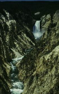 In 1872, on the recommendations of two explorers and their supporters, Congress created Yellowstone National Park.
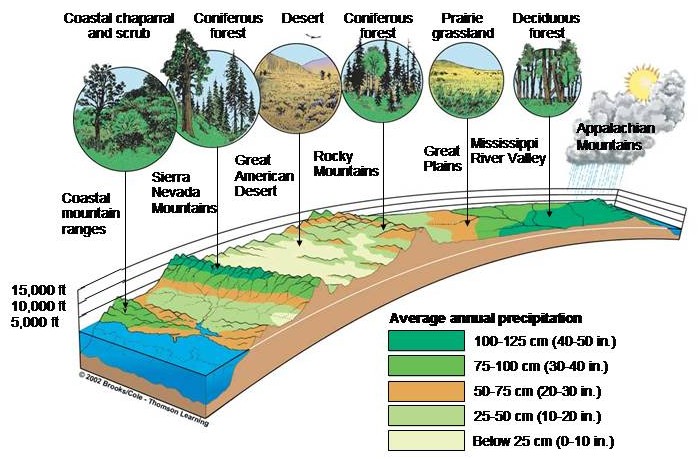
The North American landscape is characterized by a variety of ecological systems grouped together in geographically similar vegetation types called biomes.
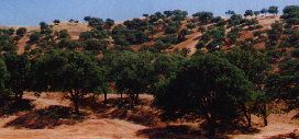

Oak Savannah woodland, the Salinas River floodplain in central California's watershed, transect of biomes, & Chesapeake Bay mouth.
America's landscape conservation heritage.
 Edward Hopper's street scene: Early Sunday Morning, 1930.
Hopper had settled in Greenwich Village, which was to be his base for the rest of his life, in 1923.
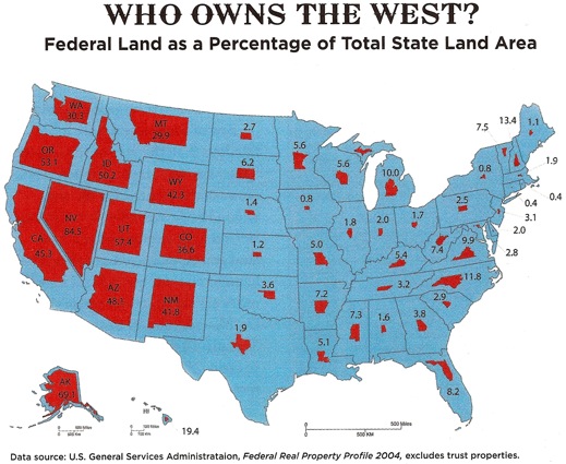
| Protected Areas: | Agency | extent (square miles) | |
|---|---|---|---|
| National Parks | Interior Department | 124,993 |
|
| National Forests | Agriculture Department | 298,438 |
|
| National Wildlife Refuges | Interior Department | 139,054 |
|
| Bureau of Land Management | Interior Department | 500,000 |
|
| Alaska Maritime Wildlife Refuge | Interior Department | 5,466 |
|
| Other federal lands: | Defense & Interior | 184,375 |
|
| Total protected area: |
|
1,253,326 |
|
| Asphalt covers: | square miles * |
61,000 |
« Where are we? | The obligation | duties | protected areas | comparing sizes | population growth | land-use | graphic «
The legacy of our landscape heritage.
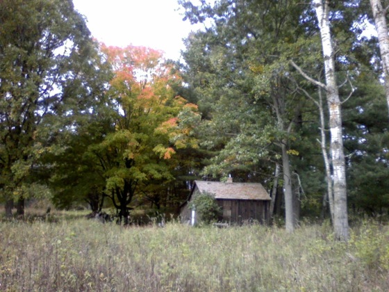
Aldo Leopold's shack in Baraboo, Wisconsin.
The comparative size, in area, of the USA:
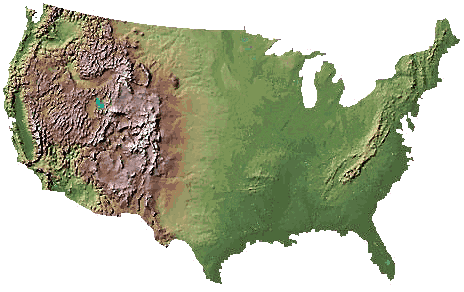
One hundredth meridian
This is the arbitrary boundary on the continent between the arid west and the more humid east. The land west of the hundredth meridian is the region where there is routinely insufficient rainfall to promote intensive agriculture.
The size of the United States:
3,696,117 square miles miles2
2,365,515,481 acres
957,311,000 hectares
« Where are we? | The obligation | duties | protected areas | comparing sizes | population growth | land-use | graphic «
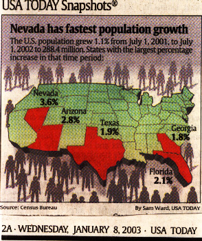
How much, in comparison to population growth is that area?
| 1990-2000 | |||
|---|---|---|---|
 |
Two contrasting measures of land | ||
| acreage | hectares | ||
1.0 |
2.5 |
||
.4 |
1.0 |
||
| 2011 growth | percentage > | 
|

|
| Nevada | 35.0 % | ||
| Arizona | 24.6 % | ||
| Texas | 20.6 % | ||
| Florida | 17.6 % | ||
| The USA grew by 9 % | |||
46% of the US is arable, meaning that it can be grazed, farmed or turned into orchards and vineyards
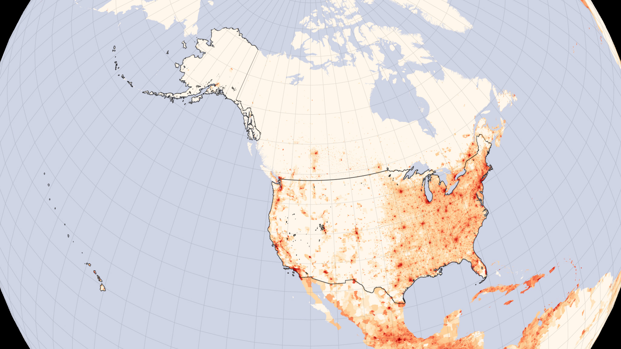
3 % of the land area in the U.S. is home to 75 percent of the population .
45% of the country is domesticated land (modification by agricultural or industrial agricultural uses).
1.8% of the land area in the lower 48 states is set-aside as wilderness; another 2.3% is in Alaska.
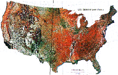
White areas are sparsely populated, tan densely populated, & red densest populations.
Land use & land use change are principal contributors to and means of ameliorating abrupt climate change because of the physical properties of land, air and water.
Where the grid pattern ends in the dry river beds of the high, arid plains.
Overview of Land use in the United States
The U.S. has 2.3 billion acres of land. However, 375 million acres are in Alaska and not suitable for agricultural production. The land area of the lower 48 states is approximately 1.9 billion acres.
To put things in perspective, keep in mind that California is 103 million acres, Montana 94 million acres, Oregon 60 million acres and Maine 20 million acres.
Developed Land- Despite all the hand wringing over sprawl and urbanization, only 66 million acres are considered developed lands. This amounts to 3 percent of the land area in the U.S., yet this small land base is home to 75 percent of the population. In general, urban lands are nearly useless for biodiversity preservation. Furthermore, urbanized lands, once converted, usually do not shift to another use.
Rural Residential Land-This category comprises nearly all sprawl and subdivisions along with farmhouses scattered across the country The total acreage for rural residential is 73 million acres. Of this total, 44 million acres are lots of 10 or more acres.
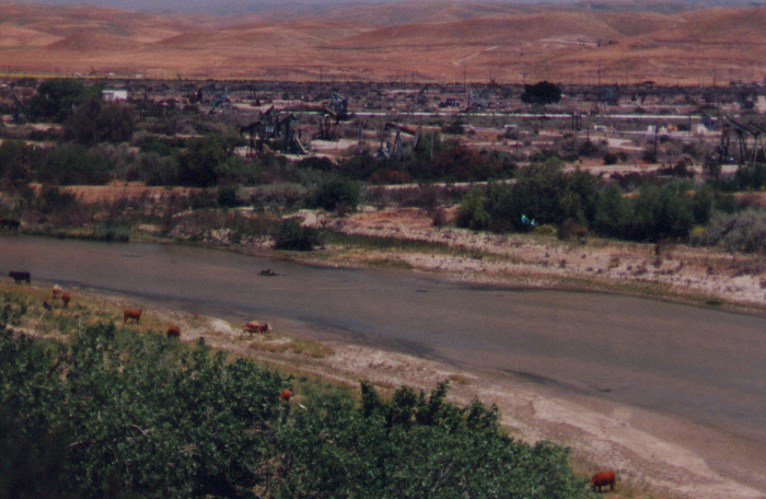
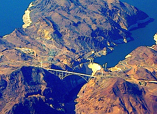
No land area in the nation could be developed without water and electricity; Hoover dam in Boulder Canyon, Nevada is a perfect symbol of this reality as it provides water and power to California's 37,300,000 and Arizona's 6,595,778 thirsty residents.
Boulder Canyon where Hoover Dam was built in 1922 creating Lake Meade on the Colorado River.
« Where are we? | The obligation | duties | protected areas | comparing sizes | population growth | land-use | graphic «
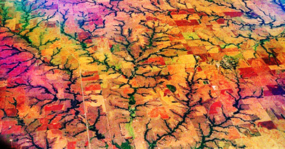
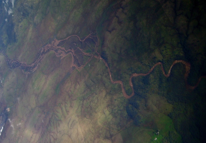
Watershed: that area of the terrain that drains into a common river, stream, and tributary system, a landscape basin.
American River, California's central valley, at flood stage winter 2005-2006.
"A river is a unit from its source to its mouth."
Gifford Pinchot, 1910
« Where are we? | The obligation | duties | protected areas | comparing sizes | population growth | land-use | graphic «
Below are a list of authors who have divergent and often contrasting views about land, landscape, land use and landscape education, but they agree on the importance of protecting our natural heritage.
Norman Myer's on the ecological importance of forests.
Lewis Mumford on our national landscape heritage.
Roderick Nash on America's wilderness heritage.
Michael Pollan on food as the litmus test for land use.
Nash versus Pollan on the importance of wild versus agrarian visions.
Paul Colinvaux Niche and stature of organisms
Ian McHarg on Design with Nature.
Bill McKibben on altering nature.
Carolyn Merchant on partnership as an ethical choice.
Sym Van der Ryn on ecological design.
Jared Diamond on caring for common property resources.
Leo Marx about literature and landscape in American writing.
Marc Reisner on what national policies for water conservation created.
How are our land use policies racist?
![]()
Watersheds Messenger Summer 2002 Vol. IX, No. 2: The Truth About Land Use in the United States
By George Wuerthner
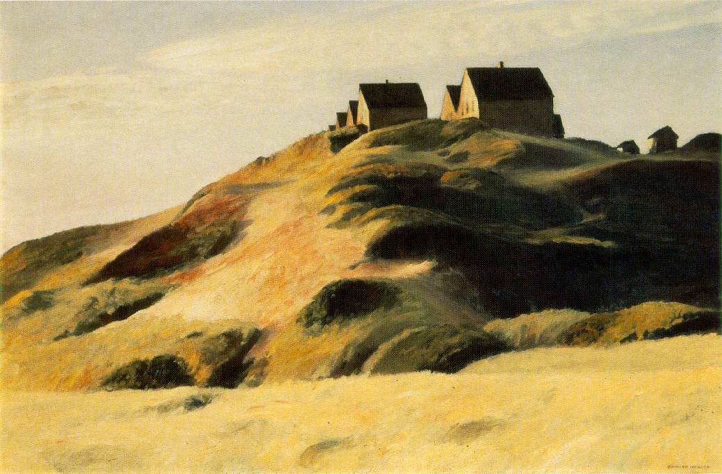
"Corn Hill," 1930 [oil on canvas] The dunes at Truro, Cape Cod, Ma. by Edward Hopper
![]()
« Where are we? | The obligation | duties | protected areas | comparing sizes | population growth | land-use | graphic «
Aldo Leopold on Thinking Like a Mountain | Round River | Country & landscape | planetary concerns
Austin | Bateson | Carson | Diamond | Ehrlich | Greider | Hardin | Jackson | Lovelock | Odum | Siry | Williams | Wilson | Worster
Technology index ![]() landscape index
landscape index ![]() words index
words index ![]() photograph index
photograph index ![]() USA Maps
USA Maps